Wildfire Containment Explained: Percent Contained and Acres Burned
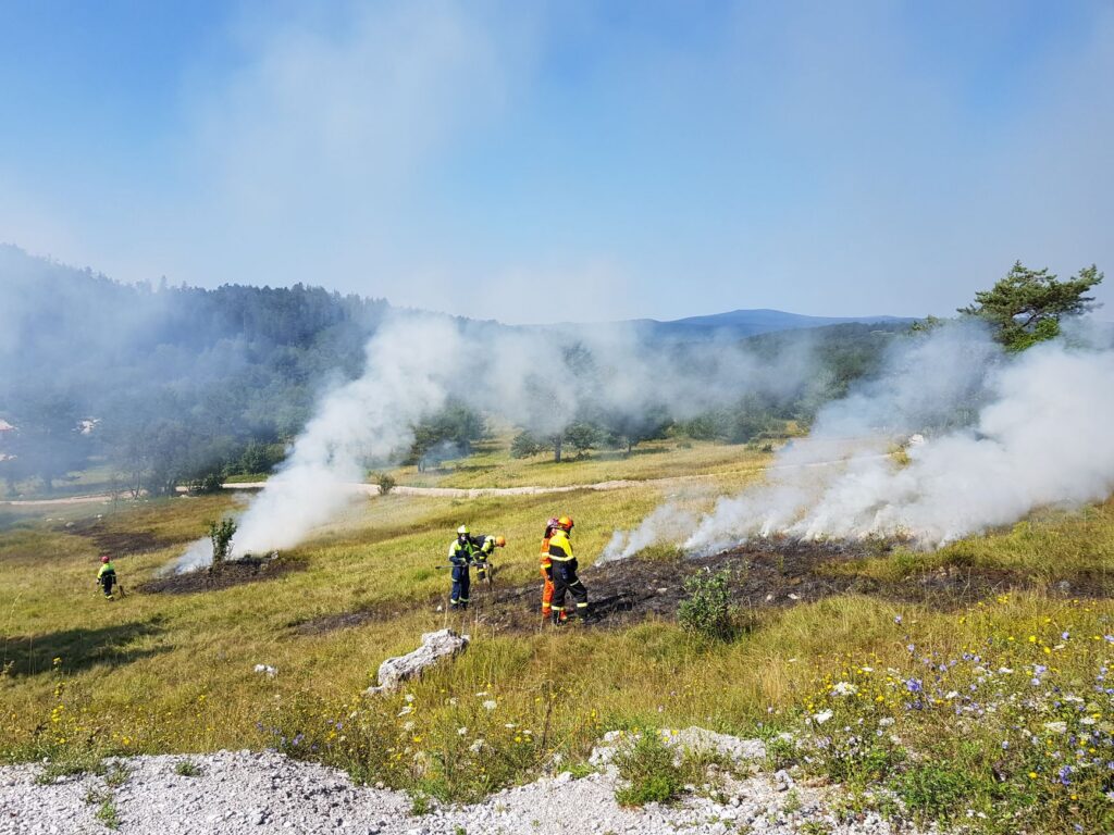
Wildfire containment is the share of a fire’s perimeter where crews have completed a control line that can reasonably be expected to stop the fire’s spread. A fire listed as 40% contained has such a line along about 40% of its edge. It does not mean 40% of the fire is out. Acres burned is the estimated area inside the fire perimeter, and early estimates often change as the perimeter is mapped more accurately.
What does “percent contained” mean?
U.S. fire agencies use definitions from the National Wildfire Coordinating Group (NWCG) Glossary of Wildland Fire. The terminology page of the Southern Area Coordination Center, part of the National Interagency Fire Center (NIFC) network, defines containment as the completion of a control line around a wildland fire and any associated spot fires, “which can reasonably be expected to stop the fires spread.”
A control line is the NWCG’s inclusive term for all constructed or natural barriers and treated fire edges used to control a fire. A road, a river or a strip cleared by crews can all serve as part of one.
Incident teams report containment as a percentage of the whole perimeter. A section counts as contained only when fire managers are confident the fire will not cross that line. Containment describes the fire’s edge. It does not say how much of the burned area is still smoldering inside.
What is the difference between contained and controlled?
Control is a later stage than containment. The table gives the interagency definitions as published on the Southern Area Coordination Center’s terminology page.
| Term | Official meaning |
|---|---|
| Containment | Completion of a control line around a wildland fire and any associated spot fires, which can reasonably be expected to stop the fire’s spread |
| Control | A control line completed around the fire, any spot fires and any interior islands to be saved; unburned area next to the fire side of the lines burned out; hot spots that threaten the line cooled, “until the line can reasonably be expected to hold under the foreseeable conditions” |
| Mop-up | Extinguishing or removing burning material near control lines, felling snags and trenching logs to prevent rolling, to make a fire safe or reduce residual smoke |
| Spot fire | Fire ignited outside the perimeter of the main fire by a firebrand |
| Complex | Two or more individual incidents in the same general area assigned to a single incident commander or unified command |
The same glossary notes that containment and control are used to report a fire’s status, such as a date of containment or a date of control. They are not names for a type of management strategy.
How is fire size measured in acres?
Fire size is the area inside the fire perimeter, reported in acres in the United States. One acre is about 0.4 hectares. The first numbers are estimates made while the fire is moving. Incident updates on InciWeb and CAL FIRE pages often revise acreage up or down after more accurate mapping with GPS, infrared flights or satellite imagery, especially once smoke clears enough for aircraft to map the perimeter.
Agencies also group fires into size classes. The NWCG glossary bases the class on the number of acres within the final fire perimeter:
| Size class | Acres |
|---|---|
| A | One-fourth acre or less |
| B | More than one-fourth acre, less than 10 acres |
| C | 10 acres to less than 100 acres |
| D | 100 acres to less than 300 acres |
| E | 300 acres to less than 1,000 acres |
| F | 1,000 acres to less than 5,000 acres |
| G | 5,000 acres or more |
For statistical purposes, the interagency glossary defines a large fire as one burning more than a specified area, giving 100 acres in shrub or timber and 300 acres in grass as examples.
How do wildfires get their names?
Local dispatch centers create the incident record when a new fire is reported. Interagency mobilization guidance from the Great Basin Coordination Center (2024) says most land management agencies recommend naming fires after geographic locations or landmarks. Because names come from local features, the same name can appear in different states.
The same guidance lists names to avoid: a person, private property or a company, the phrase “Dead Man” or “Deadman,” another catastrophic fire, or a well-publicized event that could cause confusion. When several fires are combined into a complex, the record carries the word “Complex” in its name. Each incident also gets a unique identifier built from the protecting unit and a local number; the guidance gives ID-BOD-000567 as an example.
Where do official fire updates come from?
- InciWeb (inciweb.wildfire.gov), the interagency incident information system, posts updates and announcements for many large fires.
- State fire agencies, such as CAL FIRE at fire.ca.gov, post updates on incidents they manage.
- NIFC publishes National Fire News and the Incident Management Situation Report, which summarize large fires and the National Preparedness Level on a scale of 1 to 5.
- Local emergency management officials issue evacuation notices for their communities.
Our live list of active US wildfires brings NIFC incident data and NASA FIRMS satellite detections together, with state pages such as wildfires in California. It is a way to see official data in one place, not an alert service. EPA notes that the NIFC incident feed it uses on its own smoke map can be several days old, so the incident page or state agency is the place for the latest numbers.
What do evacuation levels mean in different states?
States and local governments set their own evacuation terms, so the wording differs. Two examples from state emergency management agencies:
| State | Term | Official meaning |
|---|---|---|
| California (Cal OES) | Evacuation Warning | A potential threat to life or property. Cal OES says to assume an evacuation order could follow. |
| California (Cal OES) | Evacuation Order | An immediate threat to life and property. A lawful directive to leave; the area is closed to the public. |
| Oregon (OEM) | Level 1: Be Ready (green) | “Stay aware of the wildfire threat and get prepared.” |
| Oregon (OEM) | Level 2: Be Set (yellow) | “Be prepared to leave at any moment.” Significant wildfire danger. |
| Oregon (OEM) | Level 3: Go Now (red) | “Evacuate immediately!” Extreme danger; it is unsafe to remain. |
Sources: Cal OES on warnings vs orders (September 2025) and Oregon OEM’s evacuation levels (May 2026). Other states and counties use their own terms. Oregon directs residents to ORAlert.gov for county alerts. CDC’s wildfire guidance says: “Always follow instructions given by local emergency management officials.” Our guide on how to get emergency alerts covers phone alerts and local sign-ups.
Bottom line
Percent contained measures how much of a fire’s edge is lined and expected to hold. It says nothing about how much is still burning inside. Acreage is an estimate that changes with better mapping. Names come from local landmarks, and evacuation terms depend on your state and county. For decisions about leaving, local emergency officials are the authority; for fire weather, see the National Weather Service and our guide to Red Flag Warnings.
FAQ
Does 100% contained mean the fire is out?
No. Containment means control lines surround the fire and are expected to stop its spread. A fire is reported as controlled later, after crews burn out unburned fuel along the lines and cool hot spots that threaten them.
Why did the fire’s acreage go down?
Early acreage is an estimate. Agencies often lower or raise it after more accurate mapping with GPS, infrared flights or satellite imagery.
What is a fire complex?
A complex is two or more individual fires in the same general area assigned to a single incident commander or unified command. Its name includes the word “Complex.”
Who decides when to evacuate?
Local officials issue evacuation notices, and the terms vary by state. In California, an evacuation order is a lawful directive to leave; in Oregon, Level 3 means go now.