Satellite Fire Detections Explained: What NASA FIRMS Hotspots Mean
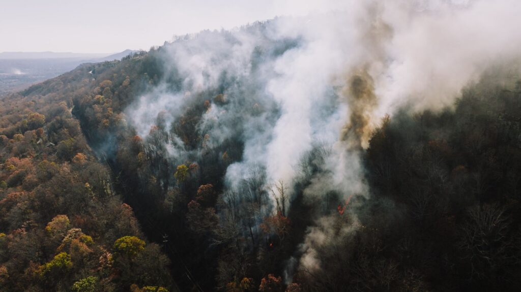
A satellite fire detection, or hotspot, in NASA’s Fire Information for Resource Management System (FIRMS) marks the center of a satellite pixel flagged as containing one or more actively burning fires. The pixel is about 375 meters (1,230 feet) across for VIIRS and about 1 kilometer (0.6 mile) for MODIS, and the fire is often smaller than the pixel. A hotspot shows heat seen from orbit; it is not an exact location and not a confirmed wildfire.
What does a FIRMS hotspot actually show?
NASA says each hotspot represents the center of a pixel flagged as containing one or more fires or other thermal anomalies. The listed location is the center point of the pixel, not necessarily the coordinates of the actual fire. At least one fire is somewhere inside that pixel.
Detection size depends on the instrument. NASA’s FIRMS FAQ says MODIS routinely detects both flaming and smoldering fires about 1,000 square meters (roughly a quarter acre) in size. NASA says the VIIRS 375 m product gives a greater response over fires of relatively small areas.
Which satellites detect fires for FIRMS?
FIRMS active fire data come from two instruments on polar-orbiting satellites. The table reflects NASA’s FIRMS pages as of November 2026.
| Instrument | Satellites | Pixel size | Confidence values |
|---|---|---|---|
| MODIS | Terra and Aqua | About 1 km | 0% to 100% |
| VIIRS | NOAA-20 and NOAA-21 (formerly JPSS-1 and JPSS-2) | About 375 m | Low, nominal or high |
A third VIIRS satellite, Suomi NPP, no longer delivers new data. NASA says its observations ceased at 13:00 UTC on November 2, 2026, and FIRMS has asked users to move to other products.
Polar-orbiting satellites pass over a given spot only a few times a day. NASA says each instrument generally has two overpasses a day, with more toward the poles. A fire that starts and ends between passes can be missed.
How quickly do detections appear?
FIRMS makes global near real-time data available within 3 hours of a satellite observation, on a best-effort basis. Some detections over the United States and Canada arrive faster. NASA says Ultra Real-Time data are available within a minute of the satellite overpass from select direct readout stations in the U.S. and Canada.
FIRMS US/Canada is a joint effort by NASA and the USDA Forest Service. It offers a fire map, data downloads and email or text alerts for satellite detections. Even with fast delivery, a hotspot on the map can be hours old, so the detection time matters.
Why is a hotspot not a confirmed wildfire?
A satellite measures heat, not cause. NASA’s FAQ asks whether all active fire hotspots are vegetation fires and answers no. NASA says most are vegetation fires, but some are volcanic eruptions or flares from gas wells.
NASA also states that different types of thermal anomalies are not currently attributed in near real-time MODIS or VIIRS data. The data you see on a near real-time map do not flag static sources or say what kind of heat a hotspot is. The detection algorithms try to screen out false alarms from bright, reflective surfaces such as metallic factory rooftops. Because a satellite records only heat, a hotspot alone cannot show whether a fire is a wildfire or a burn someone set on purpose.
EPA gives a similar caution for the analyst-reviewed fire detections on the AirNow Fire and Smoke Map. It says fire positions should be used as general guidance and not for tactical decisions, such as evacuations, without other information that confirms the fire’s existence and location.
Satellites also miss real fires. NASA lists the reasons: the fire may start and end between observations, cloud cover, heavy smoke or tree canopy may hide it, or it may be too small or too cool to detect. NASA adds that the data carry no information on cloud cover or missing data, so a blank area does not prove there is no fire.
How should you read the confidence value?
Each detection carries a confidence value. For MODIS it ranges from 0% to 100%. For VIIRS it is low, nominal or high. NASA advises that the confidence field should be used with caution.
Other details worth noting are the satellite and instrument that made the detection and the date and time of the overpass. A single low-confidence pixel and a large cluster of high-confidence pixels tell very different stories, but neither one is an official fire report.
How can you check whether a hotspot is a real wildfire?
- Note the detection time and which satellite made it.
- Look for detections on later passes and from other satellites. A hotspot that shows up in the same place day after day may be a static heat source, which near real-time data do not label.
- Compare it with official incident information: InciWeb, your state fire agency and the National Interagency Fire Center. Our live list of active US wildfires shows NIFC incidents and FIRMS detections together, with state pages such as wildfires in California.
- For smoke, check the AirNow Fire and Smoke Map; our guide to wildfire smoke and air quality explains its layers.
- For any safety decision, rely on local emergency officials and the National Weather Service, not on a hotspot.
Bottom line
A FIRMS hotspot is a satellite pixel with enough heat to flag, mapped at its center point. It can be a wildfire, a planned burn, a gas flare or a volcano, and the fire inside can be much smaller than the pixel. As of November 2026, VIIRS detections come from NOAA-20 and NOAA-21, and MODIS detections from Terra and Aqua. Use hotspots to spot activity, then check official incident pages. Our guides to wildfire containment and Red Flag Warnings explain the official terms you will see next.
FAQ
Is the hotspot the exact location of the fire?
No. NASA says the location is the center point of the pixel, not necessarily the coordinates of the actual fire. The fire can be anywhere inside a pixel about 375 m (VIIRS) or 1 km (MODIS) across.
Why didn’t FIRMS show a fire I can see?
NASA lists several reasons: the fire started and ended between overpasses, clouds, heavy smoke or tree canopy hid it, or it was too small or too cool to detect.
What happened to Suomi NPP?
NASA says Suomi NPP is no longer delivering new data and that its observations ceased at 13:00 UTC on November 2, 2026. FIRMS VIIRS detections continue from NOAA-20 and NOAA-21.
Can FIRMS send fire alerts?
FIRMS US/Canada offers email or text alerts for satellite detections. These are notices about detected heat, not evacuation alerts, which come from local officials.