Winter Weather Alerts Explained: Storm, Blizzard, Ice and Cold
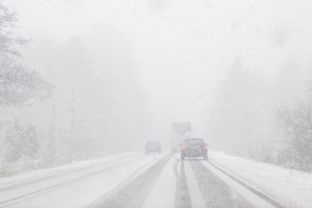
The National Weather Service (NWS) issues a Winter Storm Watch when conditions are favorable for a significant winter storm, a Winter Storm Warning when significant snow, ice, sleet or blowing snow is expected or occurring, and a Winter Weather Advisory for wintry weather below warning level. A Blizzard Warning is about wind and visibility, and an Ice Storm Warning is about ice buildup. Since October 1, 2024, the cold alerts are named Extreme Cold Watch, Extreme Cold Warning and Cold Weather Advisory.
Local NWS offices set the snow and cold thresholds, so the same alert can mean different numbers in Virginia, Minnesota and Nebraska.
What is the difference between a winter storm watch and a winter storm warning?
A watch means a significant winter storm is possible; a warning means it is expected or already happening. NWS Omaha describes a Winter Storm Watch as issued when the risk of hazardous winter weather has increased significantly, typically in the 12- to 48-hour part of the forecast. The NWS winter watches and warnings page says a Winter Storm Warning covers a significant winter weather event with snow, ice, sleet or blowing snow, and that travel may become very difficult or impossible.
The snow amount behind a warning depends on the local office:
- NWS Baltimore/Washington: 5 inches (13 cm) or more of snow or sleet for most of its area, and 6 inches in its six westernmost counties.
- NWS Twin Cities: 6 inches (15 cm) or more of snow, or half an inch of sleet, generally within 24 hours.
- NWS Omaha: 5 to 6 inches or more of snow depending on location, half an inch or more of sleet, or near-blizzard conditions.
What is a winter weather advisory?
A Winter Weather Advisory covers snow, blowing snow, ice, sleet or a mix that is expected to cause problems but stays below warning level. The NWS national winter page advises caution while driving.
The thresholds vary again by office. NWS Baltimore/Washington issues one for any amount of freezing rain or for 2 to 4 inches of snow, and also for 1 inch of snow forecast during weekday rush hours in the Baltimore and Washington areas. NWS Twin Cities uses 3 to under 6 inches of snow, and NWS Omaha uses 3 to 5 inches.
What makes blizzard and ice storm warnings different?
A Blizzard Warning is defined by wind and visibility, not by snowfall. The NWS issues one for sustained winds or frequent gusts of 35 mph (56 km/h) or more with falling or blowing snow, frequently reducing visibility to less than a quarter mile (400 m) for three hours or more. NWS Omaha notes that no snowfall amount is required, and NWS Baltimore/Washington notes that there is no temperature requirement.
An Ice Storm Warning is about ice, not wind. The NWS says Ice Storm Warnings are usually issued for ice accumulation of around a quarter inch (6 mm) or more. NWS Omaha’s criterion is generally a quarter inch or more within 12 hours or less. The NWS says this much ice can make roads dangerous and bring down power lines and tree branches.
A new option started this season. On or about October 1, 2026, the NWS began allowing “Particularly Dangerous Situation” wording in Blizzard Warnings and Ice Storm Warnings. According to NWS Service Change Notice 26-52, the wording is for high-confidence cases of a blizzard or ice storm of extreme and historic severity that poses an exceptional threat above a typical event.
What happened to wind chill warnings?
They were renamed. Under NWS Service Change Notice 23-44, effective on or about October 1, 2024:
- Wind Chill Watch and Extreme Cold Watch were combined into the Extreme Cold Watch.
- Wind Chill Warning and Extreme Cold Warning were combined into the Extreme Cold Warning.
- Wind Chill Advisory became the Cold Weather Advisory.
- Hard Freeze Watch and Hard Freeze Warning became Freeze Watch and Freeze Warning.
In its announcement of the cold alert changes, the NWS said the goal is to make clear that cold can be dangerous with or without wind. The new alerts are based on wind chill or the actual air temperature. Some older NWS web pages still show the Wind Chill names.
How do the winter and cold alerts compare?
| Alert | What it means | Example criteria (local NWS office) |
|---|---|---|
| Winter Storm Watch | A significant winter storm is possible | Typically 12 to 48 hours ahead (Omaha) |
| Winter Storm Warning | Significant snow, sleet, ice or blowing snow expected or occurring | 6 in or more of snow, or 1/2 in of sleet (Twin Cities) |
| Winter Weather Advisory | Wintry weather below warning level | 3 to under 6 in of snow (Twin Cities) |
| Blizzard Warning | Strong wind with snow and very low visibility | Winds or frequent gusts of 35 mph or more, visibility under 1/4 mile, 3 hours or more |
| Ice Storm Warning | Damaging ice accumulation | About 1/4 in of ice or more |
| Snow Squall Warning | A short, intense burst of snow | Visibility 1/4 mile or less in snow with subfreezing roads; usually an hour or less (Twin Cities) |
| Extreme Cold Warning | Dangerously cold temperatures or wind chills | -30°F or colder (Omaha); -10°F or colder east of the Blue Ridge (Baltimore/Washington) |
| Cold Weather Advisory | Cold below warning level | -20 to -29°F (Omaha); 0 to -9°F east of the Blue Ridge (Baltimore/Washington) |
The cold thresholds show how much local criteria differ. NWS Twin Cities issues an Extreme Cold Warning for wind chills or temperatures colder than -35°F in the Minneapolis–St. Paul metro and colder than -40°F to the north and west.
Which winter alerts reach your phone?
Few of them. The NWS list of warnings it sends as Wireless Emergency Alerts includes Snow Squall Warnings, but not Winter Storm, Blizzard, Ice Storm or Extreme Cold Warnings. To see those, check weather.gov by ZIP code, NOAA Weather Radio or our live list of NWS alerts by state, for example active NWS alerts for Minnesota. Our pages show official NWS data in one place and are not alerts themselves. Our guide to how official emergency alerts reach you covers the other channels.
What does the NWS advise in extreme cold?
The NWS wind chill chart shows how quickly cold and wind can injure skin: at 0°F with a 15 mph wind, the wind chill is -19°F, and exposed skin can freeze in 30 minutes. The NWS extreme cold safety page advises staying inside during severe cold and, if you must go out, dressing in layers and covering exposed skin.
The NWS lists redness or pain in any skin area as a possible first sign of frostbite. It says a body temperature below 95°F means hypothermia, which needs medical attention right away. The NWS also says portable generators should run outdoors, at least 20 feet (6 m) from doors, windows and garages, to avoid carbon monoxide poisoning. Follow instructions from your local emergency officials.
Bottom line
Winter Storm Watch means a big storm is possible, Winter Storm Warning means it is coming or here, and Winter Weather Advisory means lesser but still hazardous winter weather. Blizzard Warnings depend on wind and visibility, Ice Storm Warnings on ice. Wind Chill alerts no longer exist: since October 1, 2024, they are Extreme Cold Watches, Extreme Cold Warnings and Cold Weather Advisories. Exact thresholds come from your local NWS office. Heat alerts were renamed the same way in 2025, as covered in our guide to heat alerts, and the general rules are in watch vs warning vs advisory.
FAQ
Does a blizzard warning need heavy snow?
No. A Blizzard Warning is based on sustained winds or frequent gusts of 35 mph or more and visibility under a quarter mile for three hours or more. Blowing snow that is already on the ground can meet the criteria, and NWS Omaha notes that no snowfall amount is required.
Is the Wind Chill Warning still issued?
No. On or about October 1, 2024, the NWS replaced the Wind Chill Warning with the Extreme Cold Warning and the Wind Chill Advisory with the Cold Weather Advisory. The new alerts can be issued for cold air temperatures even when there is little wind.
What is the difference between a winter storm warning and an ice storm warning?
A Winter Storm Warning covers significant snow, sleet, ice or a combination. An Ice Storm Warning is specific to ice accumulation, usually around a quarter inch of ice or more, which the NWS says can bring down power lines and branches.
What is a PDS blizzard warning?
Since on or about October 1, 2026, the NWS can add Particularly Dangerous Situation wording to Blizzard Warnings and Ice Storm Warnings. The NWS says it is for high-confidence events of extreme and historic severity, beyond a typical blizzard or ice storm.