California Earthquake Faults: San Andreas, Hayward and San Jacinto
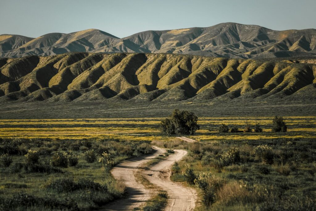
California’s best-known earthquake faults are the San Andreas, the Hayward in the San Francisco Bay Area and the San Jacinto in Southern California, among hundreds of known active faults in the state. The USGS UCERF3 forecast puts the chance of one or more magnitude 6.7 or larger earthquakes in the California region within 30 years at greater than 99 percent.
Why does California have so many faults?
California sits on the boundary between two tectonic plates. The USGS UCERF3 fact sheet says California is sandwiched between the Pacific and North American plates, with the Pacific plate moving northwest about 2 inches per year relative to the North American plate.
That boundary is not one clean crack. The USGS describes it as a fragmented zone, and its fault model for UCERF3 includes more than 350 fault sections. The California Geological Survey (CGS) says California has hundreds of known active faults and that most Californians live within 30 miles of one of them.
The San Andreas is the main strand. According to the USGS, the San Andreas fault system is more than 800 miles (1,300 km) long and as much as 10 miles (16 km) deep in places. It is a fault zone made of many segments, not a single continuous fault. The average rate of motion across the zone over the past 3 million years is 56 mm (about 2 inches) per year.
What are California’s main earthquake faults?
The table lists the faults that official sources single out, with their largest historical earthquakes from the USGS catalog.
| Fault | Where it runs | Key facts from official sources |
|---|---|---|
| San Andreas | More than 800 miles (1,300 km) through the state; its northern end reaches Cape Mendocino | M7.9 Fort Tejon earthquake, January 9, 1857; M7.9 San Francisco earthquake, April 18, 1906 |
| Hayward | East Bay, from Fremont north through Berkeley | M6.8 earthquake on October 21, 1868; USGS calls it the most urbanized earthquake fault in the US |
| San Jacinto | Branches off the San Andreas near Cajon Pass and runs southeast about 150 miles (240 km) into the Imperial Valley | Called the most seismically active fault in Southern California in the USGS fault database; M6.6 Borrego Mountain (1968) and M6.6 Superstition Hills (1987) |
| Calaveras | San Francisco Bay Area | UCERF3 raised its odds of M6.7+ quakes threefold over the previous model |
What happened in the big San Andreas earthquakes?
The 1857 Fort Tejon earthquake ruptured the San Andreas from near Parkfield almost to Wrightwood, a distance of about 300 km (about 190 miles), according to the USGS. Horizontal displacement reached as much as 9 meters (30 feet) on the Carrizo Plain. Strong shaking lasted 1 to 3 minutes, and one person was killed.
The 1906 San Francisco earthquake ruptured the northernmost 296 miles (477 km) of the San Andreas, from northwest of San Juan Bautista to Cape Mendocino. The earthquake and the fires that followed caused an estimated 3,000 deaths, according to the USGS. A broken pipeline from San Andreas Lake cut off the city’s water supply, which let the fires spread.
The USGS compares the two: the 1906 break was longer, but the maximum and average displacements in 1857 were larger.
Why does the USGS watch the Hayward fault so closely?
The Hayward fault runs through the urban core of the East Bay. A USGS feature on the Hayward fault calls it the single most urbanized earthquake fault in the United States. Alameda County had 24,000 residents in 1868 and now has more than 2.4 million.
The October 21, 1868, earthquake was magnitude 6.8 and killed about 30 people. Ground cracking was traced for 20 miles along the fault, from Warm Springs in Fremont north to San Leandro. Almost every building in the town of Hayward was wrecked or severely damaged.
USGS scientists have found evidence of 12 earthquakes on the southern Hayward fault in the past 1,900 years. The last six came at intervals of 95 to 183 years, an average of about 150 years. The USGS says the fault may be ready to produce another magnitude 6.8 to 7.0 earthquake. The USGS does not give a date for it.
What are the odds of a big California earthquake?
The odds come from UCERF3, the third Uniform California Earthquake Rupture Forecast, described in USGS Fact Sheet 2015-3009. It gives the likelihood of one or more earthquakes of a given size in the next 30 years, starting from 2014. The values include aftershocks.
| Region | M6.7 or larger | M7.0 or larger | M7.5 or larger | M8.0 or larger |
|---|---|---|---|---|
| Greater California | >99% | 93% | 48% | 7% |
| Northern California | 95% | 76% | 28% | 5% |
| Southern California | 93% | 75% | 36% | 7% |
| San Francisco region | 72% | 51% | 20% | 4% |
| Los Angeles region | 60% | 46% | 31% | 7% |
UCERF3 also names individual faults. The southern San Andreas has a 19 percent chance of one or more magnitude 6.7+ events in 30 years near Mojave, which the USGS calls the most likely fault to host a large earthquake. The northern San Andreas is lower, at 6.4 percent near San Francisco, partly because it broke in 1906. The USGS says the Hayward-Rodgers Creek and Calaveras faults now rival or exceed the northern San Andreas.
The model changed some faults sharply. The San Jacinto fault’s odds of magnitude 6.7+ quakes fell threefold from the previous model, while its odds of magnitude 8+ rose by a factor of 57. The USGS explains that the fault “traded some moderate-sized events for rare larger ones,” because UCERF3 allows ruptures to jump between faults. The 1992 Landers earthquake was one of the recent quakes that did exactly that.
Statewide, the average time between magnitude 6.7+ earthquakes is about 6.3 years in UCERF3. The USGS stresses that actual repeat times vary a lot and almost never match the average.
How many earthquakes does California have?
Most California earthquakes are small. The USGS says Southern California has about 10,000 earthquakes each year. Only several hundred are larger than magnitude 3.0, and only about 15 to 20 are larger than magnitude 4.0. A large earthquake adds many more through its aftershock sequence, explained in our guide to aftershocks.
How can you check faults and earthquakes near you?
- Look up your address on CGS’s EQ Zapp map, which shows fault and seismic hazard zones for any parcel in California. The zones come from the Alquist-Priolo Earthquake Fault Zoning Act, passed in 1972 after the 1971 San Fernando earthquake, as described on the CGS Alquist-Priolo page.
- See our live list of USGS earthquakes in California for the last 24 hours, 7 days and 30 days.
- Compare magnitude with how strongly a quake was felt where you are; our guide to magnitude vs intensity explains the difference.
- Learn how official early warnings reach phones in our ShakeAlert guide.
Our pages show official USGS data in one place and do not issue warnings. For preparedness steps, follow your local emergency officials.
Bottom line
California’s faults exist because the Pacific plate slides northwest past North America at about 2 inches a year. The San Andreas, Hayward and San Jacinto carry the most attention, but UCERF3 counts more than 350 fault sections and puts the 30-year chance of a magnitude 6.7+ somewhere in the state above 99 percent. Regional odds are lower: 72 percent for the San Francisco region and 60 percent for the Los Angeles region.
FAQ
Which California fault is most likely to cause a big earthquake?
In UCERF3, the southern San Andreas is the most likely to host a large earthquake. It has a 19 percent chance of one or more magnitude 6.7+ events in 30 years near Mojave.
How long is the San Andreas fault?
The USGS says the San Andreas fault system is more than 800 miles (1,300 km) long. It is a zone of many segments, and movement can occur on any of them.
When was the last big earthquake on the Hayward fault?
The last large Hayward fault earthquake was the magnitude 6.8 of October 21, 1868. The USGS found that the last six large Hayward earthquakes came 95 to 183 years apart, about 150 years on average.
Is UCERF3 an earthquake prediction?
No. UCERF3 is a forecast of probabilities over 30 years for whole regions and faults. It does not give the date, place or size of any single future earthquake.